Petroleum Africa
Find us on: 


Tuesday, February 13, 2018
February 12, 2018 – Over 95 percent of projects in the process industry are retrofits or expansions of existing plants that seek to increase capacity, comply with regulations, or introduce new technology to improve performance. Moreover, often the building of a new plant is done on the brownfield site of an existing facility. For all these projects, capturing and modeling the existing context is critical to decision making and both conceptual and detailed engineering design. Bentley’s reality modeling technology is increasingly being leveraged to support these critical workflows.
In this year’s submissions for the Be Inspired Awards, there are five excellent examples using reality modeling technology in the process industry, demonstrating how this technology has now become an essential part of any brownfield or greenfield plant design project.
UCB, a global biopharmaceutical company, is using reality modeling for its iconic manufacturing plant in Belgium (which was established in 1928) to assess options and communicate ideas to help this complex and established site become carbon neutral by the year 2030. Context Capture was used to create an engineering-ready 3D model of the entire complex, including all the buildings, production facilities, roads, and parking areas, using both drone and terrestrial photography. This context enabled the engineering team to quickly produce a 3D model to convey ideas and determine options. Point-cloud data from laser scans was then added to the model to enable accurate quantities to be calculated and precise measurements to be given to contractors for the priority work packages.
ABS Steel needed to modernize the fume extraction system for its large steel complex in Udine, Italy to meet new regulations. It did not have a survey of the entire site since the complex was the result of a merger of two plants in 1988. ABS Steel awarded the contract to BM Engineering to survey the site. It used laser scanning for inside the plant and photography for outside the plant, creating a combined engineering-ready model in MicroStation using ContextCapture and Bentley Pointools, which was read into AECOsim Building Designer and used to design the new fume extraction system. The model was then used to test the structural integrity of the aging parts of the factory. By using a drone to capture photos of the roofs of the industrial buildings, and using ContextCapture to accurately create the 3D model, the project avoided the need to construct at least 70,000 temporary structures (guardrails, walkways, ladders, PPE, etc.) to conduct the survey work.
FlightlineGeographics LLC (FlightlineGeo) solved a problem for an owner of an ethanol plant in Kansas, United States whose plant expansion was impeded by a lack of a drainage plan that would satisfy the local municipality. Traditional alternative methods, such as ground surveying and either ground or aerial LiDAR, were eliminated as possible solutions due to the
short time frame and limited project budget involved. It was decided to use a drone (UAV) and, once survey ground control was placed, the UAV capture of the 200-acre site was completed in a single one-hour flight. The team used ContextCapture to produce the 3D model that engineers needed to quickly calculate the results for the drainage and construction study, which was presented to municipal authorities a few days later. Moreover, the team leveraged the same work to create a 3MX reality mesh that could then be used for visualization within the Acute 3D viewer. It took just one week to conceive, capture, process, and deliver the project, and gain approval.
Technical Solutions International (RBI) is a world-class engineering inspection company headquartered in Durban, South Africa. RBI has deployed a solution that combines the use of unmanned autonomous vehicles (UAVs or drones), 3D reality modeling software (ContextCapture), a geographical information system (Bentley MAP), and engineering documentation management (ProjectWise) to manage the entire inspection process. Its clients include petrochemical, pulp and paper, power generation, and telecommunications firms. The new process enables RBI to deliver more competitive services to its clients that speed survey time considerably and increase the value and visibility of its inspection survey data.
“UCB SA is driving a ‘smart factories’ initiative, leveraging Industry 4.0 and Bentley technology. Our objective is to reorganize production so that we are more adaptable and effective in the allocation of resources. We store our engineering data in ProjectWise for better collaboration among colleagues. Using ContextCapture for 3D modeling of our site provides geo-referencing and allocates geographical coordinates to our data. Analyzing the 3D model together with the orthophoto drawings provides the official record of our land registry data, waterways, and buildings. We can also bring this 3D model into AECOsim Building Designer to support any building design changes. For proposed modifications to our production facilities, we use OpenPlant Modeler and OpenPlant Isometrics to provide precise 3D data for contractors and to automate the detection of clashes between pipes, structures, and equipment.” said Joseph Ciarmoli, Head of CAD engineering, UCB SA.
“The interoperability of Bentley products has made it possible to optimize and significantly reduce the survey and reality modeling time, while also allowing a BIM model to be created that can easily be used by all stakeholders (structural and plant designers), who have decidedly and significantly improved the efficiency of their integrated design, allowing the implementation of the first revamping phase to be reached just three months after delivery of the BIM model.” Said Marco Barberini -BM Engineering s.r.l.
“Reality modeling using Context Capture from Bentley enabled FlightlineGeo to process a large amount of data into information for the client in near real time. The project was completed ahead of time and under budget, allowing the company to acquire its expansion permit and move on with production of renewable energy.” Commented Devon Humphrey, CEO, FlightlineGeo.
“Bentley’s range of products and integration between their products and our automated UAV systems gives us and our clients an added advantage against an ever-improving competitive
market. The future we live in today.” Said Stanley du Toit, Technical and Solution Director, RBI Technical Solutions International.
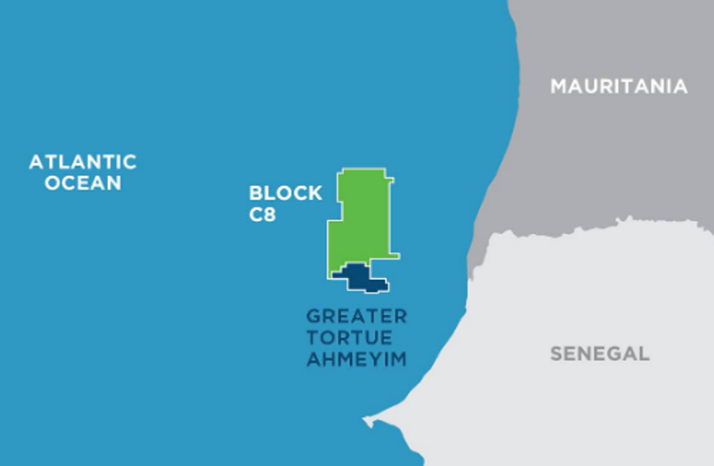 " alt="First LNG Realized at the Greater Tortue Ahmeyim Project">
 " alt="United Energy Acquires Western Desert Producer APEX">
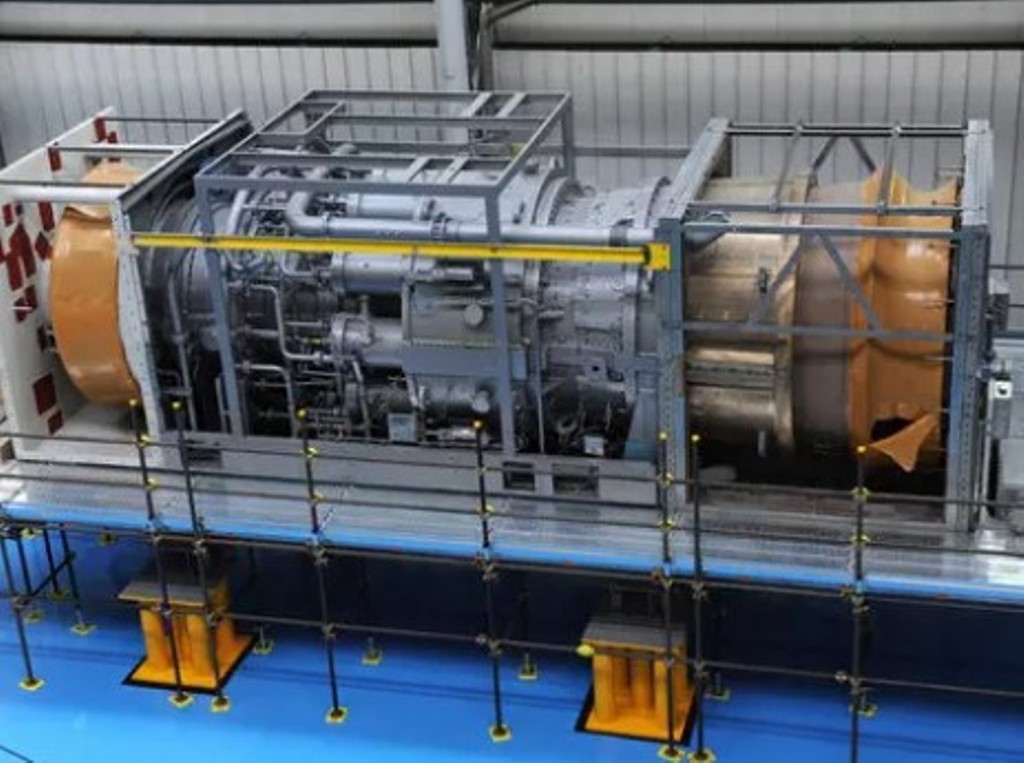 " alt="Baker Hughes Announces Major Gas Technology Orders for Venture Global LNG">
 " alt="Tullow Highlights 2025 Operational Plans in Ghana">
 " alt="TotalEnergies to Supply 1.5 TWh to STMicroelectronics in France Over 15 years">
 " alt="Oil & Gas Crucial for African Growth: AEC Calls for Industry Support to Defend African Market">
