Petroleum Africa
Find us on: 


Tuesday, September 24, 2013
CGG’s full-azimuth, long-offset towed-streamer marine broadband acquisition solution is delivering exceptional subsalt images in the Gulf of Mexico.
A year after its launch, CGG’s innovative subsalt imaging solution, StagSeisTM, is producing exceptional results in terms of improved imaging and illumination in the Gulf of Mexico. Early results from the multi-client IBALT survey, presented at last year’s SEG convention, were sufficiently impressive to merit a second survey, IBALT Deux, being commenced on its completion in January. The most recent results have fully validated that decision.
StagSeis is a multi-vessel acquisition technique, employing two multi-streamer vessels and three additional source vessels in a proprietary staggered configuration. Sail lines are acquired in an anti-parallel fashion in two orthogonal passes, allowing data to be acquired with four axes of ultra-long offsets up to 20km and full azimuths up to 10km. The configuration used for IBALT acquired offsets up to 18km and full azimuths to 9km. This survey was acquired over 221 full fold license blocks of Keathley Canyon in the Gulf of Mexico. Fast Trax processed data from a priority area is available now. About 10% of this survey still remains to be shot, as a drilling rig is currently in the area, and will be acquired when this rig has vacated; one of the advantages of this acquisition geometry is that it can be easily extended or infilled. The second StagSeis acquisition, IBALT Deux, is currently underway, covering 357 adjacent blocks and is scheduled for completion in October, with Fast Trax data available in May 2014
The beauty of this staggered acquisition technique is that it combines all the recent advances in marine acquisition, such as BroadSeisTM variable-depth streamers for broad bandwidths, continuous overlapping recording for longer records and Dovetail fanned acquisition for reduced infill, to provide full-azimuth, long-offset, broad-bandwidth data in an efficient manner. The improved azimuth distribution provides better illumination as well as improved noise and multiple attenuation. The ultra-long offsets improve the imaging of steep dips and increase the accuracy of salt and subsalt velocity models. The broad bandwidths supplied by BroadSeis allow the acquisition and processing of reliable low-frequency data down to 2.5 Hz with high signal-to-noise ratio and greater stability for seismic inversion. The improved penetration of low-frequency, long-offset energy also provides stronger and more continuous subsalt reflectors.
The linear tow of the staggered acquisition design provides regular fold with consistent rich offset and azimuth distribution. Data can therefore be processed using existing wide-azimuth 3D algorithms for faster turnaround and be used for future development and 4D surveys as it can be easily repeated and/or interleaved to finer sail lines.
The figure below compares StagSeis results with those from previous wide-azimuth acquisition, and clearly demonstrates improvements in subsalt continuity and fault definition, thanks to improved illumination, enhanced velocity modeling and stacking.
By combining full azimuths and long offsets with broadband technology, it is also possible to obtain the proven benefit of ultra-low frequencies for subsalt imaging, without compromising the high-resolution near-surface data required for shallow hazard identification. Low frequencies also provide more quantitative inversion results, without the need for low-frequency models derived from well data. This combination of low frequencies from BroadSeis and long offsets and full azimuths from StagSeis is ideal for Full Waveform Inversion (FWI) to derive detailed, accurate velocity models for improved imaging. The benefits of low frequencies for FWI have been demonstrated in various areas around the world. The benefits of full azimuths and long offsets for determining the velocities of the complex overburden in this area of the Gulf of Mexico have been shown. Combining both these sets of benefits provides geologically meaningful models of unmatched quality. The full-azimuth information also enables detailed anisotropy analyses to be performed for use in Tilted ORthorhombic (TOR) imaging, enabling better resolution of faulting, and derivation of the direction of fast velocity and azimuth anisotropic epsilon which accurately match the seismic.
Visit CGG at SEG booth 2542 to see the stunning IBALT Fast Trax results and find out more about how StagSeis combines the latest acquisition and advanced subsurface imaging techniques to deliver the best-quality seismic data.
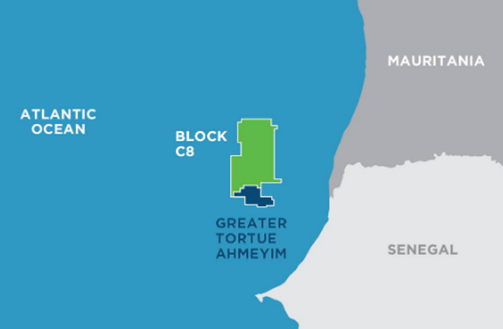 " alt="First LNG Realized at the Greater Tortue Ahmeyim Project">
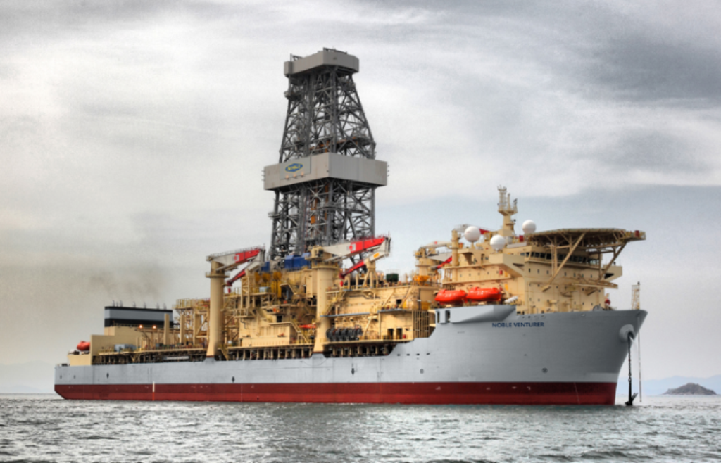
 " alt="United Energy Acquires Western Desert Producer APEX">
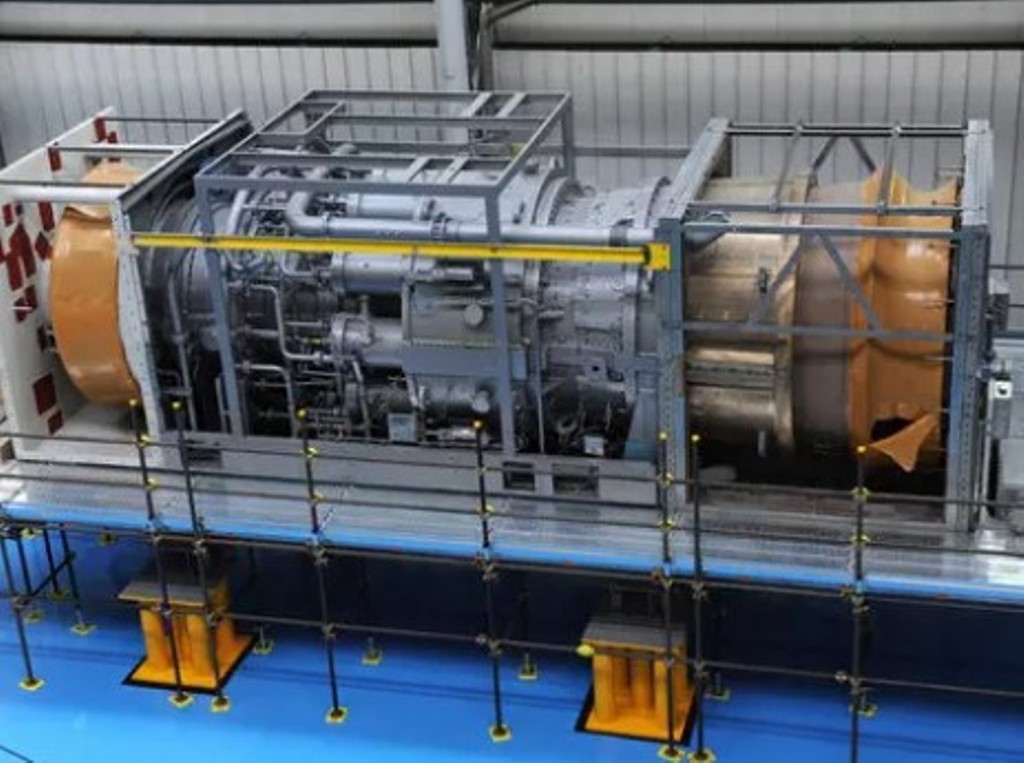 " alt="Baker Hughes Announces Major Gas Technology Orders for Venture Global LNG">
 " alt="Tullow Highlights 2025 Operational Plans in Ghana">
 " alt="TotalEnergies to Supply 1.5 TWh to STMicroelectronics in France Over 15 years">
 " alt="Oil & Gas Crucial for African Growth: AEC Calls for Industry Support to Defend African Market">
